Six Drives With Fantastic Views
You’ll Want To Get Out Of The Car And Explore
I’m always on the lookout for a day trip with something to do or see – I love riding around in the Jeep, but it’s always better if you see something amazing or fun along the way. Fun stuff can include old cabins, ruins, old wells, springs, waterfalls, lakes, cliffs – pretty much anything that makes you want to get out of the car and explore.
However, some of the roads we’ve been on aren’t much along the way, but the view you get at the end is what makes it worthwhile. So here are six of the drives I’ve been on that give you amazing views – either as a reward at the end, or as a wonderful surprise along the way. A couple of these require a high clearance vehicle or 4WD, but a couple of them you can do in a car.
Edge Of The World
This drive takes a while, but it’s doable with two-wheel drive and and moderate clearance, and the reward is well worth it. Start out just west of Flagstaff on I-40. We actually had to go past the road and backtrack, so we took the South Flagstaff Ranch exit and went south to West Kiltie Lane and headed east until we got to South Woody Mountain Road.
You can also look up the Flagstaff Arboretum and use those directions, since it’s along the road you want. I found this road on www.trailsoffroad.com, and they say it takes about an hour and a half, but we stop all the time and wander around, so for us from Phoenix it was 326 miles total and took the whole day.
A View All Across The Sedona Area
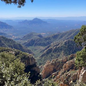
South Woody Mountain Road is also FR231 and you just stay on that road all the way. It’s also called East Pocket Road. It’s a good gravel road with a few washboard areas, mostly near the beginning. Near the end it might be a little rougher, and of course weather will make a difference. You’ll pass the Arboretum and a lovely place called Rogers Lake that has a lot of great trails with signs telling you about the wildlife. We plan to go back there sometime.
What you’re really after is the views near the end of FR231 and it’s going to take you a while to get there. We went on a weekday and there was almost no traffic. The Edge of the World is what they call the area near East Pocket, because from there you get a magnificent view all across the Sedona area including amazing canyons and bluffs.
Go Before The Snows Or Wait ‘Til Spring
There are dispersed campsites all along the edge, but I wouldn’t camp there if I had kids. Keep your dog leashed – it’s a long way down. The road ends shortly after the viewing area, but there are a bunch of little spurs all along the edge and each one gives you a slightly different view. Go back the same way you came – there’s no other way out. Absolutely stunning views. Go before the snows or put it off until spring – and try to go when the sky is clear. It was hazy when we went, and my photos don’t do it justice.
FR801
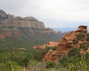
This road absolutely requires 4WD or at least high clearance. We spent a whole day in this area and saw some big bucks – mule deer and Coues, and had a great time in the Jeep. Find this road by taking the Schnebly Hill Road exit south of Flagstaff and head west. After you pass Foxboro Lake Dam (there’s water and a wooden sign), watch on your left for the road marker that says 801,roughly a mile past Foxboro. Turn left and just stay on 801 all the way to the end. It’s an out and back road, so you have to go back the way you came. This is a very rough, bumpy road with several places that have embedded boulders. Definitely not for cars.
Keep A Map App Open
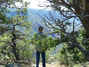
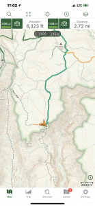
The view is just before the end of the road. Keep a map app open – Gaia and Topo Maps are both good, and you’ll see where the road swings closest to the edge of the canyon. The canyon is represented by contour lines very close together. We just stopped along here and walked over to the edge, with Mochi on a leash. There are only a couple of places where you can stand and get a good view, but it’s absolutely gorgeous – you’re looking out over Woods Canyon (not the lake).
The road continues to the trails and a big waterhole. It’s not a very long road, but there are plenty of other roads around near the beginning of 801 so you can keep busy all day exploring. There are lots of waterholes and a big radio tower area as well.
Perkinsville Road
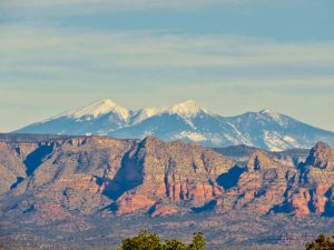
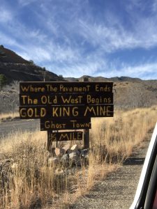
Unless the weather has been really bad, this road is totally doable with two-wheel drive and average clearance. It’s a very good gravel road. We start from Phoenix, so for us this was an all-day drive. We got on Perkinsville Road just north of Chino Valley and ended up in Jerome, then went home. From Highway 89 north of Prescott Valley, we took Perkinsville Road east all the way to the Verde River crossing near Perkinsville. The views when you get to the plateau on the way are stunning – red rock bluffs with the San Francisco Peaks beyond them. We went in December of 2018 and there was snow on the Peaks.
Through Jerome
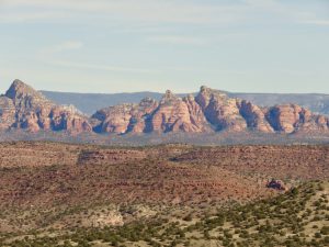
On the way back, we went through Jerome (the turns are well marked), and the views from that part of the road are spectacular too. One particularly good viewing spot even has a little kiosk and a bench. We stopped and ate lunch there. The bridge over the Verde is fun – it’s a great little one-lane bridge and you can get out and walk around down by the water. This remains one of my favorite drives of all time.
Schnebly Hill Road
This is definitely a 4WD road, or at the very least, for high-clearance vehicles. It’s incredibly rocky with some steep boulders to get over, and add to that the fact that it is almost always a busy road because it is famous for its views.
I think the best way to approach it is to get on Schnebly Hill Road off I-17 just south of Munds Park – exit 320. You’ll drive through some beautiful woods and pass some tanks and water, then suddenly you’ll find yourself on the edge of the ridge and see an incredible spectacle of red rock bluffs and formations ahead. If you come in from this side you’ll be going downhill so the views are ahead of you.
The Views Are Worth It
This is a very popular road for OHV’s, so be prepared to be passed by long caravans of them. You’ll also likely meet a variety of Jeep and OHV tour vehicles. There really isn’t anyplace to stop along this road, so make sure your passenger has the camera. Going in this direction, the passenger side has the best photo opps. You’ll see red rock formations almost the entire way down.
We went in November and had changing leaves as well, so it was doubly gorgeous. The road ends in the middle of Sedona, so if you go on a weekend be prepared for the traffic. The views are worth it, though, and if you don’t have a Jeep or OHV of your own, you can always catch a tour in Sedona.
Sycamore Point
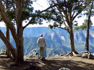
Last year, John and I decided to spend a few days in the Williams area and explore. We went to all the little lakes (and there are a lot of them), camped, and had a great time. I noticed on the map a spot called Sycamore Point, right on the edge of Sycamore Canyon. This large and rightfully famous canyon is known for spectacular waterfalls at certain times of the year, but I had never been to it.
Basically, you take the Perkinsville Road south from Williams to the White Horse Lake Road, then turn down JD Dam Road to FR12. There you bear east (left) onto Sycamore Point Trail. This part of the road is a bit rougher and probably requires a high clearance vehicle. It crosses a big plateau that actually looks pretty empty except for junipers, but when you reach the end of the road you’re at Sycamore Point.
This One Won’t Disappoint
There is room to park several vehicles, so hop out and explore. Leash the pup! You can walk all along the edge of the canyon in both directions, and since it takes a turn there you get all different views. It’s amazing – it almost takes your breath away when you first see it because it’s so unexpected after that plateau. This one won’t disappoint!
Harquahala Mountain
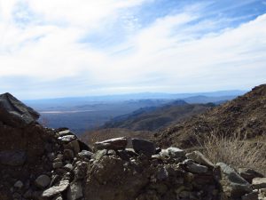
This is a National Back Country Byway and since there are plenty of steep and possibly slippery sections and some rough spots, the signs say it’s for 4WD only, but it’s a pretty easy road, especially since they paved the short stretch that caused the most problems. Catch this road by taking Highway 60 west of Wickenburg to the town of Aguila.
In Aguila, watch for Eagle Eye Road and turn south. Watch the road for signs that tell you you’re coming to the Harquahala Mountain National Back Country Byway – it’s about 4-5 miles south of Aguila. Turn right, and soon you will come to a very nice rest area with bathrooms and shaded kiosks with lots of information about the road and the solar observatory up top.
A Super Day Trip From Phoenix
The dirt road makes its way up the mountain and it’s desert all the way, but we’ve seen Coues deer, coyotes, burros, and all kinds of smaller critters along the road. When you get to the top you will find a bunch of buildings and signs that tell you about the history of the solar observatory. By walking around the top of the mountain you can get fantastic views in all directions. It really is a stunning spot, and it’s a great place to take winter visitors so they get a taste of the desert and have a lot of fun as well. There are picnic tables at and near the top, and scattered primitive campsites along the road. This one makes a super day trip from Phoenix during the cooler months.
The Rewards Are Incredible
So there you have it – six day trips that reward you with incredible views. I hope you try one or all of these soon.


